Pictures and Stories About Bicycle Tour Adventures
Butte, Divide Creek, Wise River, Elkhorn Hot Springs, Polaris,
Bannack State Park, to Grant, Montana; June, 2012;
Beaverhead-Deerlodge National Forest in the
Pioneer Mountain Range of the Rocky Mountains;
Great Divide Mountain Bike Route (GDMBR - Segment)
Day 4 - Elkhorn Hot Springs to Grant, Montana,
By Way of the Great Divide Mountain Bike Route (GDMBR)
Above: It is near freezing! Terry is in our Cold Weather configuration: Balaklava, Gloves, HD Flannel shirt, Neoprene Foot Booties, and GoreTex (wind stopping) Jacket.
The temperature is 38-42F/2-4C at this elevation (~6,000'/1830m) and it is colder in the valley (read on).
We learned later that our friends John and Ava spent the night in Bannack State Park and their water froze on them, in fact their day was prolonged just dealing with early morning thawing issues (been there ourselves).
Above: As noted at the End of Day 3, we got up earlier than planned because of a mouse rummaging through our cabin's trash (at Elkhorn Hot Springs); other issues too. We had an unpleasant stay there. OK, enough said.
Maverick Ski Resort
We're on the road at ~0600 Hrs. It is just above freezing and our first run is a steep downhill slope. I really do not like riding down hills with my brakes on but I had to because it was just too cold.
Above Left: About 2.5 miles south of Elkhorn. This is the only gas for fifty miles in one direction and a hundred miles in all other directions and their service is truly just for the local needs. I'm sure that local people have a member discount. The Inn is reputed to be very pleasant; it is a ski resort atmosphere (Maverick Ski Resort, pictured above). At the time of this picture, the national average for a Gallon of Regular Unleaded Gasoline was $3.65/Gallon.
Above Right: About 3.5 miles south of Elkhorn. If we had it to do over, this is where we'd stay. It is about a mile downroad from the Grasshopper Inn. It is worth the little uphill pedal climb!
Notice that we are out of the Forest now.
We're going from Montane to Savanna to Semi-Arid Ecological Zones today.
Above Left: The Iron Elk (left side), nice home too.
Above Right: The town of Polaris, Montana (time to change GDMBR Maps).
Above: We spook a Teenage Moose as we enter the town of Polaris.
Above Left: Fine looking bottom land, the only green grass around.
Above Right: Grass bailing operation (first class, one of two to be seen all day). The high fence is to keep Deer and Elk from jumping into the stored Grass area (easier to see on the left side of the image).
Above Left: We're at a spot called Tash Overlook. This is the Tash Ranch and it is a huge operation - Everything here is Tash Ranch to include most of the valley in this view.
Above Right: This image is just to the right of the preceding Tash Ranch image. While we were standing at the overlook, a huge Eagle took off from sage brush about 30'/10m away from us. We think that it just captured a mouse. The Golden Eagle flew to the tree at the center of the picture and it stayed there, making loud piercing eagle Cree calls. The tree did not appear to have a nest. We departed in about 5 minutes. We could hear the eagle for another 20 minutes.
Above: After cycling about 300 yards/meters, we saw both sides of the Tash Ranch Gateway - Nice Herford Bull.
Above Left: Across the street from the Tash Ranch. That is a whole lot of grass, about the most that I've ever seen stored in one location. It looks like it serves as a wind break in the Winter and it is easily obtainable during the Winter months.
Above Right: We're trecking down the Great Divide Mountain Bike Route (GDMBR) on Montana's Hwy-73. We are about 3-4 miles from turning left onto CR-278.
Above Left: We're turning left (East) onto CR-287. CR-287 is shared with the Trans America Bicycle Trail. We see a Trans America traveler within a couple of minutes and another in about 10 minutes. How could I tell a Trans American bike from a GDMBR bike? Trans Amer's typically ride on skinny road bike tires (even though they have panniers and are probably on a road bike) and GDMBR bikers tend to ride on knobby or extra wide tires (and may be riding on a road bike or a mountain bike).
Above Right: CR-287 for about 8 miles/13 k.
Above Left: Interesting feeder/trough/tank.
Above Right: Old truck from a closed logging operation.
Above Left: This is a rather common ranch gate design for Montana.
Above Right: River Valley ahead (Grasshopper Creek), we cross and then turn right (South) for Bannack State Park. It is about 1000 hrs and we are only an hour away from our destination. We decide that we will bike more miles today than scheduled - Where was this easy road biking on Day 1 or 2?
Above: The Cowboys in these pictures are rounding up cattle and driving them to other pastures or cutting some stock out for other purposes.
Cowboy Note: We will see the Cowboy in the Red Shirt (in the left image) and the Cowboy on the Brown Rump Pinto (in the right image) again, in eight more images, in another location further down the road, very near Bannack State Park.
Above Left: Grasshopper Creek (Montana).
Above Right: It is warm now. We stopped here to take off our cold weather gear, put on sun screen, and eat our mid morning trail snacks. We had a few cars drive by and give those short beeps on their horns which, to us, always means Hey, what you are doing is Cool!
Above Left: We're officially in Sage and Rattlesnake country.
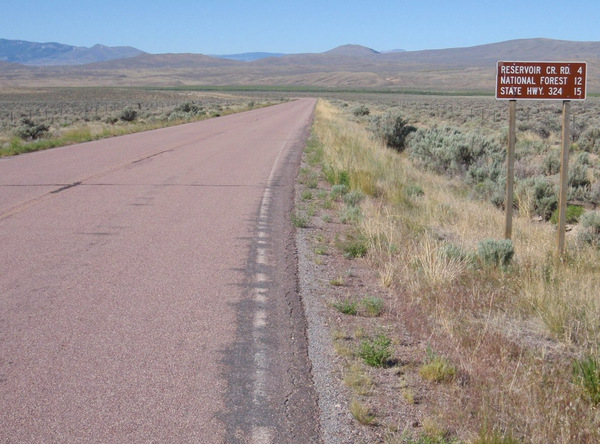
Above Right: Turn right for Bannack State Park (still 4 miles ahead).
Above Left: Sign for for Bannack, ahead.
Above Right: After we settle into Bannack and pickup the shuttle we will go to Hwy-324/Grant and bike back to Bannack.
Above Left: Wow, the reader can see Bannack State Park on the handlebar bag's GDMBR Map (the Yellow 'thumb sized spot' just left of center on the map). BTW, we're on a new Section Map, we changed at Polaris (where we saw the Moose). We're cycling Southward.
Above Right: About 20 Bovine being herded. These two Cowboys were in our earlier photos, we noted their passing of us in their Pickup and Horse Trailer, they even gave short beeps. It just took us a while to catch-up with them. This is an over the back 'reverse direction' photo, looking North.
Above Left: We're looking south; this Ranch is on the same creek as Bannack State Park (which is about a mile further to the left/east).
Above Right: We've turned into the Gateway for Bannack State Park. We intended on taking more pictures at the park (there is a Ghost Town there) but we will run into a little travel difficulty later in the day (read on).
Above Left: We are checked into Bannack State Park and I had ridden the Enduro back to Elkhorn to pick-up the Shuttle Car. Next, I will leave the Enduro at Bannack State Park and pickup Terry and we will drive to Grant on Hwy-324 and bicycle back to Bannack State Park. Shuttling takes time but things are working well and we are ahead of schedule (at the moment).
Above Right: Upon off loading the bicycle at Grant, MT, this little critter suddenly appeared to check us out.
For the Record, in the town of Grant (about ten buildings): The Cafe and Motel are closed and will be for a while.
Above Left:Wild Roses growing on the barbed-wire fence. This will be the last green (more or less) that will see until arriving at Bannack. We're looking West, in the direction of the town of Grand (just around the bend). We will be cycling to the North (to the right).
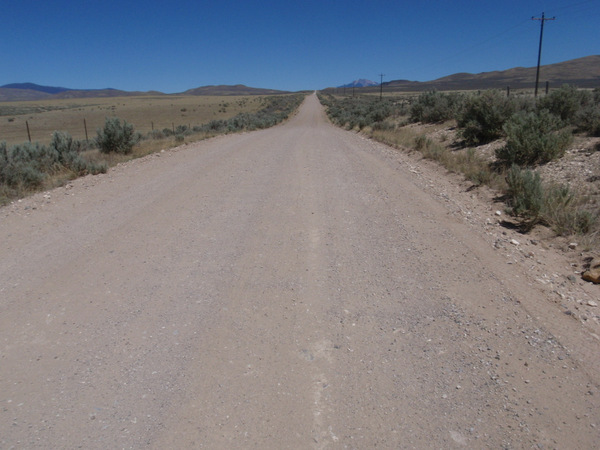
Above Right: We're off, about 13 miles to go; it's all semi-arid desert terrain now!
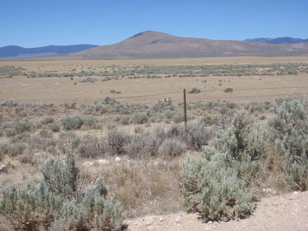
Above: The geographic name for the ridgeline is "Bannack Bench", it is the high point between Grant and Bannack State Park and the highest road elevation is about 6030'/1840m.
Above: We're done, the image is of an old lava wall. We just added 13 more miles of GDMBR Travel to our Bucket List.
The Story: I rode the Motorcycle to pick up the Shuttle Car (parked near the town of Grant), loaded the motorbike onto the shuttle car's trailer, and then headed off for the area of Medicine Lodge (our termination point for the next cycling leg). I met John and Ava along the way and we got to chat for a while. I then dropped off the shuttle motorcycle (at a Camp near Medicine Lodge) and started heading back to Bannack State Park. <Queue the Theme Music to Dragnet>
The Rest of the Story:
I transported the Enduro to a location near Medicine Lodge (for our next night's stay). While driving back to Terry (who was at Bannack State Park) I had traveled about five miles when I had a flat tire on the Transport Vehicle. I was able to change the tire with no problems but now it was late, about 1600 hrs. I was located about as remote as a person can get from civilization and now I had no spare tire. There was not enough time to drive anywhere and get the tire fixed that evening. I realized that the tire could not be fixed or replaced until tomorrow. Do we go now or wait till tomorrow? Hold that thought.
Then, it came to me that the logistics involved for gaining just a few hours of cycling time on the next day, the last day, were not justifiable - We would have spent half the day driving around just to find a tire repair store and all of the effort would only yield, at most, four more hours for cycling time (and likely only two hours). So, while driving, I kind of came to realize that we needed to 'Bite the Bullet' and 'Pack it In'. The bike trip was over (tomorrow was the last day scheduled for us to pedal on the Divide). Of course I needed to run all of this thinking by my Better Half but I would not see her for another 2 hours.
I, first, drove the shuttle car and trailer back to pick up the motorbike (30 minutes), driving more carefully now (as I had no spare tire for the Transport Car). I re-loaded the shuttle motorcycle onto the trailer and I met Terry 2 hours later. She, of course was worried, but could do nothing; we didn't even have a cell phone signal in this area. Terry agreed with my thinking and since we had not set up camp, we decided, correctly, to terminate the wonderful adventure and leave Bannack State Park right then. Sure enough, it took us about 1.5 hours to get to the Interstate and no Tire Centers or Repair Centers were available along our route. We drove on to Idaho Falls (toward home), arrived at sunset, spent the night in a motel and bought a new tire at Sam's Club the next day at opening time (the old tire was ruined from driving on it). Thank You Jim for helping us.
So, other than having a 'trip ending' flat tire on the transport vehicle; We had an astonishingly wonderful good time and
We met some adventurous people!
Post Bicycle Tour - Road Images on the Way Home
Above Left: North end of the High Park Fire at Northern Colorado - The largest fire, in acreage, ever recorded in Colorado (caused by lightning). Note: Forest Fires involving just trees usually burn with clean white smoke; Forest Fires involving manmade structures usually burn with dirty black smoke.
Above Center: The back road near Medicine Lodge, MT, was so rough that it caused a flat tire and the loss of the trailer's license plate.
Rough road bounce literally caused the plate to shear off at the mount.
Above Right: Looking west across Colorado Springs (from Black Forest): This is a 'Controlled Burn' and 'Back Fire' to further prevent the Waldo Canyon Fire from re-entering the west side. The fire destroyed 347 Homes, the most homes ever destroyed by a fire in Colorado's history. We, unknowingly, returned to Colorado Springs at exactly the same time as the President of the United States.
 Jacket.")


.")


 on Montana's Hwy-73.")
 onto Montana's CR-287.")


.")


.")